$129,000 • waterfront access
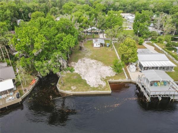
Price reduced to $129k! this property won't last long. don’t wait! once in a lifetime opportunity to own one of the most beautiful lake, river, canal front properties. this one of a kind, highly sought-after tarragona point is available after years of document/legal preparation. boundary/wetlands surveys completed 10.18. this exceptional waterfront property is divided by private canal with 2.46 acres north and 15.9 acres south of canal. northern 2.46 acres sits at end of tarragona way and has 395’ lake george waterfront, 273’ st. johns riverfront, 346’ canal waterfront. this unique property forms a perfect peninsula with incredible unspoiled views of lake george and st. johns river. southern 15.9 acres has 2,110’ of st. johns riverfront and adjacent to ocala national forest. it's considered wetlands by recent survey thus price reduced to reflect buildable uplands on the 2.46 acres north of the canal. see survey. an informal wetland application has been submitted to the dep on november 1 to verify the 3rd party survey and upland area. this area is buildable with little “avoidance and minimization” of mitigating the wetlands. an existing dirt filled road is in place from the end of tarragona way through the property to the buildable upland area. there are many, many options for this beautiful, unique waterfront property. cut and paste for extraordinary aerial of property: https://1drv.ms/u/s!ar3kouxcm0tnmvhe-kbgoh-zizntoverOther Land -
TARRAGONA WAY, ASTOR, FL 32102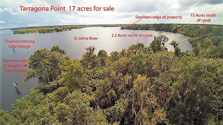
Date Sold 12-12-2018
Sold Price$60,000 Asking Price$129,000
Share by:
- Lot size 740520sqft
- Taxes: Register to see
-
Days on market:
96 day(s) Original Price:
$375,000Tax Legal Description:
ARRENDONDO GRANT BEG@SE COR LOT 7 BLK A OF CKS FOREST SHORES SUB PB 15 PG 15 RUN N 72-09-35 E ALONG E'LY EXTENSION OF N'LY R/W LINE OF TARRAGONA WAY A DIST OF 60 FT,| N 17-50-25 W 118.85 FT TO WATER LINE LAKE GEORGE E'LY ALONG SAID WATER LINE LAKE GEORGE TO A POINT WHERE THE SAID MEAN HIGH-WATER LINE OF LAKE GEORGE INTERSECTS WITH| THE MEAN HIGH-WATER LINE OF ST JOHNS RIVER, THENCE S'LY & | E'LY & SE'LY ALONG THE MEAN HIGH-WATER LINE OF THE ST JOHNS | RIVER TO E LINE ORIGINAL MA GALBREATH TRACT RECORDED IN BOOK92 PG700 THEN S 24-0-0 W602 FT TO SE COR OF THE M. A. GALBREATH TRACT N 67-45-31 W2599.26 FT TO SW COR OF MA GALBREATH TRACT N 03-29-15 W TO A POINT LYING 20 FT N'LY OF & PARALLEL TO S PROPERTY LINE OF MA GALBREATH TRACT, THENCE S 67-45-31 E 927 FT, N 17-50-25 W | 629FT TO SE COR LOT7 BLK B SAID CK FOREST SHORE PB 15 PG 15 N 72-09-35 E 60 FT N 17-50-25 W 100 FT S 72-09-35 W 60 FT TO NE COR OF LOT 7 BLK B, N 17-50-25 W 50 FT TO POB ORB 5142 PG 1863Tax Year:
2017-
MLS:
V4902620 -
Property Type:
Land -
Waterfront:
Yes Waterfront Description:
River Front Lake Creek
Special Listing Conditions:
NoneLot Features:
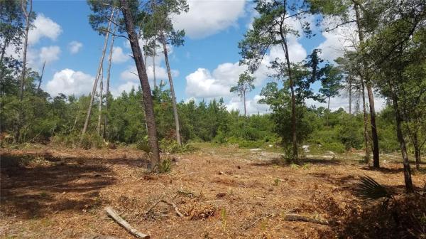
Irregular Lot In County Level May Need To be Filled Street Dead-End